Västervik, SE · 57.76°N
Swedish Agency commission · 2018–ongoing

Before they leak.

Ticking environmental bombs along the Swedish coast.

Visualization based on Ocean Discovery's photogrammetry of wrecks on the Baltic seabed.

← All projects

Along the Swedish coast lie around 30 acutely hazardous wrecks — vessels that sank 60–80 years ago with oil, chemicals or ammonia on board. Corrosion weakens the hulls year by year. The question is no longer if but when the deterioration causes a spill — and in a fragile sea like the Baltic, the consequences can last for decades. Preventive remediation requires that we first know exactly what each wreck looks like, what it contains, and how it can be reached.

Since 2018, Ocean Discovery has documented 19 such wrecks for the Swedish Agency for Marine and Water Management. Our geo-referenced 3D models with millimetre precision are used by HaV for prioritisation decisions and by the remediation contractor for planning and execution. Five wrecks have been remediated based on our documentation — 558,000 litres of oil plus ammonia recovered instead of leaking into the sea. The Malmi remediation was carried out at 180 metres depth, beyond diver reach. Every documentation is a spill that can be prevented.

— The work in numbers

Wrecks documented
19

Since 2018, for HaV

litres of oil
558 000L

Recovered in remediations based on our documentation

Remediated + under active operation
5+2

Skytteren, Lindesnäs, Malmi, Harburg and Mundogas remediated. Bruin and Magdalene under active operation.

max depth
180m

Malmi remediation at 180 m depth — beyond diver reach

Geographic overview

19 wrecks documented — from Skagerrak to the northern Baltic. Click a marker for details.

  • Remediated
  • Oil confirmed
  • Documented

Timeline 2018–2026

  1. 2018

    First HaV commission

    The first assignment was M/S Bremsund — a pilot project that established the survey methodology HaV has used ever since.

  2. 2019

    Malmi · Lindesnäs · Immen

    Three wrecks documented in 2019: Malmi (180 m depth, 44 nm NE of Gotska sandön), Lindesnäs and Immen. Lindesnäs was emptied of 299,000 litres of oil later the same year.

  3. 2020

    Skytteren documented

    Sweden's highest-priority hazardous wreck — 170 m long at 74 m depth off Måseskär — received full photogrammetric 3D documentation. 22 hull holes and a 4.2 m crack were identified that previous multibeam surveys had missed.

  4. 2021–2022

    East coast surveys

    Harburg, Mundogas (gas tanker, 2,095 tonnes of ammonia) and Nynäs 1 surveyed in 2021–2022.

  5. 2023–2024

    Malmi remediated at 180 m depth

    44,000 litres of oil recovered from three of six investigated tanks. A specially developed ROV-based hot-tap system enabled the operation at extreme depths beyond diver reach.

  6. 2024

    Six Karlskrona wrecks · Harburg remediated

    Brise, Bruin, Magdalene, Molund, Monestra and Östanhav were documented 25 nm southeast of Karlskrona. In parallel, Harburg was remediated of 40,000 litres of heavy oil from two fuel tanks in the Stockholm approaches.

  7. 2025

    West coast survey · Mundogas remediated

    Five wrecks (Florida, Pionier, Buccaner, Duvan, Taifunen) identified in collaboration with JD-Contractor. In parallel, the Mundogas remediation of ammonia and fuel was completed.

  8. 2026

    Karlskrona test drilling

    JD-Contractor carried out test drilling on four Karlskrona wrecks. Oil was found in Bruin (15 holes, five locations including two bottom tanks and the engine room) and Magdalene (19 holes, two tanks with small amounts, 1–2 m³). No oil was found in Molund (18 holes) or Östanhav (12 holes). Our 2024 point clouds were used directly in EIVA 3D navigation.

Case study 01

Skytteren — Sweden's highest-priority hazardous wreck

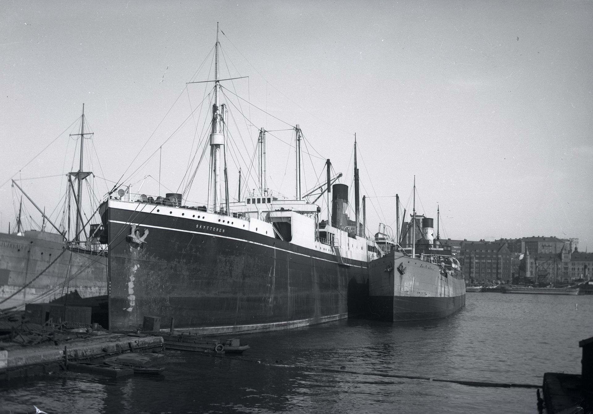
The 170-metre cargo ship S/S Skytteren sank in 1942 at 74 metres depth off Måseskär on the Swedish west coast. The wreck site lies directly adjacent to a sensitive archipelago — both marine fauna and coastlines are at risk. Before our survey, Skytteren ranked number one on HaV's list of the 30 most hazardous wrecks in Swedish waters.

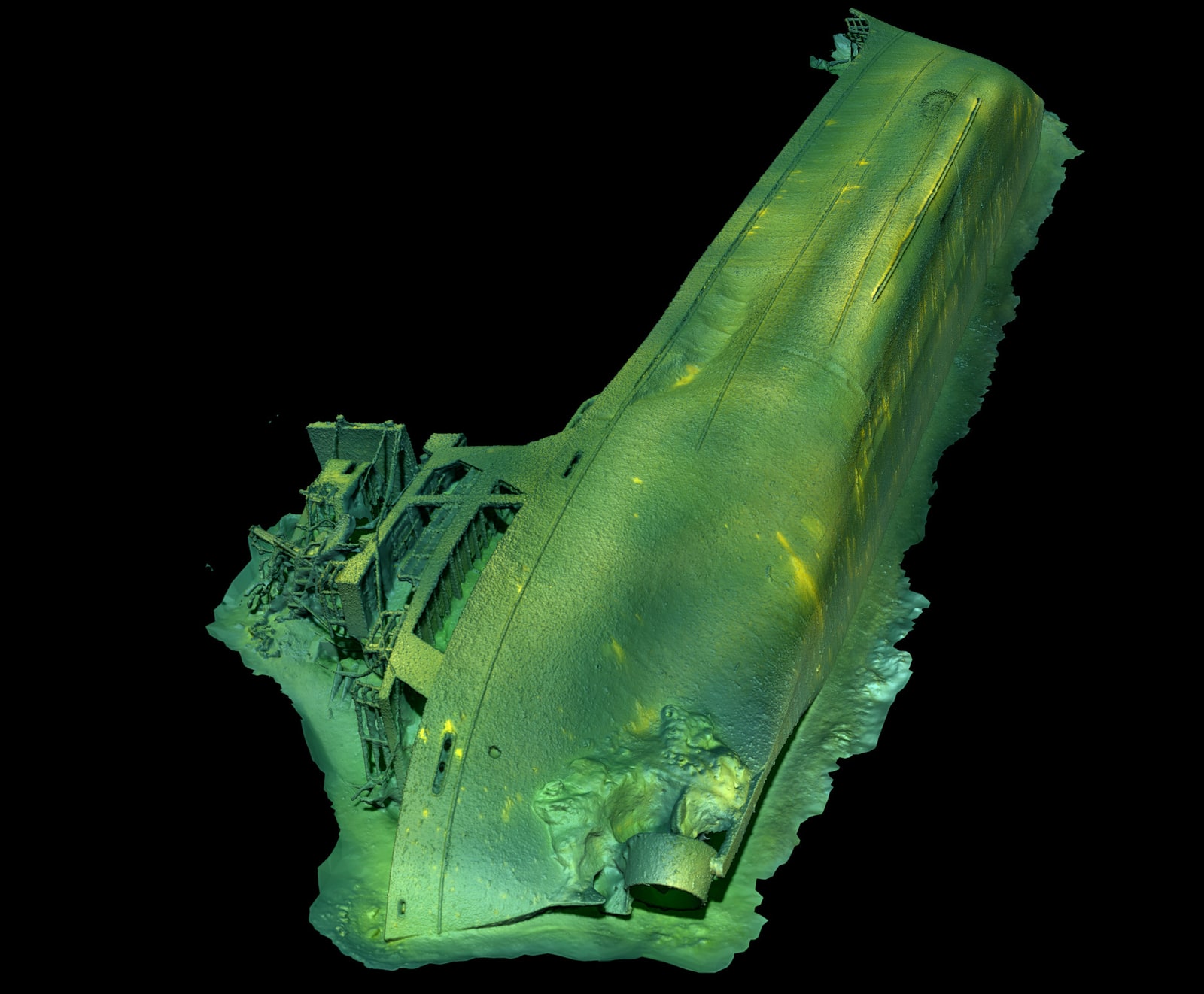
Ocean Discovery's 2020 documentation identified 22 hull holes and a 4.2-metre crack — damage that previous multibeam surveys with lower resolution had not detected. The high accuracy of photogrammetry made them visible. The subsequent remediation recovered 175,000 litres of oil and oil-mixed water.

The survey used ROV, side scan sonar and over 25,000 high-resolution images. Water-parameter measurements showed strong bottom currents and high oxygenation — conditions that drive rapid corrosion.
S/S Skytteren 3D model from photogrammetric documentation

Case study 02

The Karlskrona wrecks — point clouds in test drilling

During summer 2024, six wrecks were documented 25 nautical miles southeast of Karlskrona at 62–64 metres depth: Brise, Bruin, Magdalene, Molund, Monestra and Östanhav. Identification was made possible by overlaying the photogrammetric 3D model with historical GA drawings.

In April 2026, JD-Contractor A/S carried out test drilling on four of these wrecks. The operation read Ocean Discovery's point clouds directly into the EIVA 3D navigation system — the remediation contractor could position drilling equipment with centimetre precision at over 60 metres depth. On Bruin, 15 boreholes were drilled and oil was found in five locations — two bottom tanks (about 43 m³ each) and the engine room. On Magdalene, 19 boreholes were drilled with oil in two tanks on the south side, but only small amounts (up to 1–2 m³). No oil was found in Molund or Östanhav. More than 5 tonnes of ghost fishing gear were also recovered — our photogrammetry let the team trace each trawl net in 3D and plan exact cutting points in advance.

Our documentation cut field time and reduced risk — every drilling position could be planned in advance.

Photogrammetric 3D model of M/S Magdalene 25 nm southeast of Karlskrona

Case study 03

Malmi — remediation at 180 m depth

M/S Malmi sank in 1979 en route between Gdynia and Turku. The wreck lies 78 km northeast of Gotska sandön at 172–182 m depth — too deep for divers. Simulations showed that an uncontrolled oil spill could reach Gotska sandön-Salvorev (a Natura 2000 area and national park).

Ocean Discovery's 2019 documentation formed the basis for HaV's remediation decision. During 2023–2024, a specially adapted ROV-based hot-tap system was developed for tank penetration at extreme depth. Oil was recovered from three of six investigated tanks — a total of 44,000 litres of oil and oil-mixed water.

The depth and dramatic technical complexity make the Malmi remediation one of the most advanced underwater operations carried out in Swedish waters.

Case study 04

Lindesnäs — full cycle from documentation to remediation

The tanker Lindesnäs sank in 1957 off Oxelösund carrying 1,732 cubic metres of aviation kerosene. Simulations showed that an uncontrolled spill would reach the Natura 2000 areas Bråviken and Hävringe-Källskären.

Our documentation of the wreck preceded HaV's remediation decision. In August–September 2019, HaV led the remediation together with JD-Contractor A/S — 299,000 litres of oil were recovered from one of Sweden's most hazardous wrecks. The operation cost approximately SEK 21 million funded through the government appropriation for remediation of contaminated areas.

Lindesnäs represents the single largest oil-volume remediation where our documentation served as input.

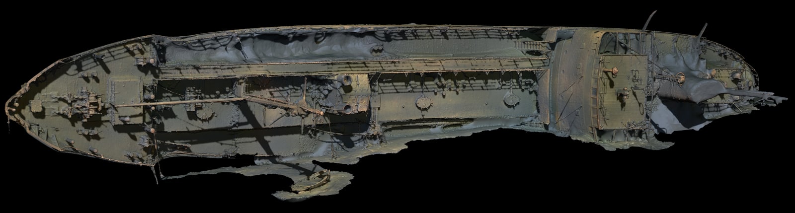
Photogrammetric orthophoto of the Lindesnäs wreck's deck side

Our method

Every wreck survey combines several techniques to create a measurable digital record.

  • Side scan sonar (SSS) — maps the wreck site and surrounding seabed.
  • Multibeam echo sounder (MBES) — high-resolution 3D bathymetry of the site and bottom topography.
  • ROV-based photogrammetry — 5,000–10,000+ high-resolution images with 70–90 % overlap generate a 3D model at 1.5–2 mm pixel resolution.
  • Ultrasonic hull-thickness measurement at representative points — input for assessing structural deterioration.
  • Water-parameter measurement with the EXO3 multi-parameter sonde (salinity, temperature, oxygen content) — input for assessing corrosion conditions.

All measurements are geo-referenced to the Swedish coordinate system SWEREF99 TM, enabling direct integration into the remediation contractor's 3D navigation system such as EIVA.