Marine archaeological documentation of shipwrecks and maritime remains — we combine photogrammetry, ROV, and sonar to deliver measurable data for archaeological assessment, heritage impact assessment, contract archaeology, and long-term site management. Without touching the site.
Archaeological 3D mapping
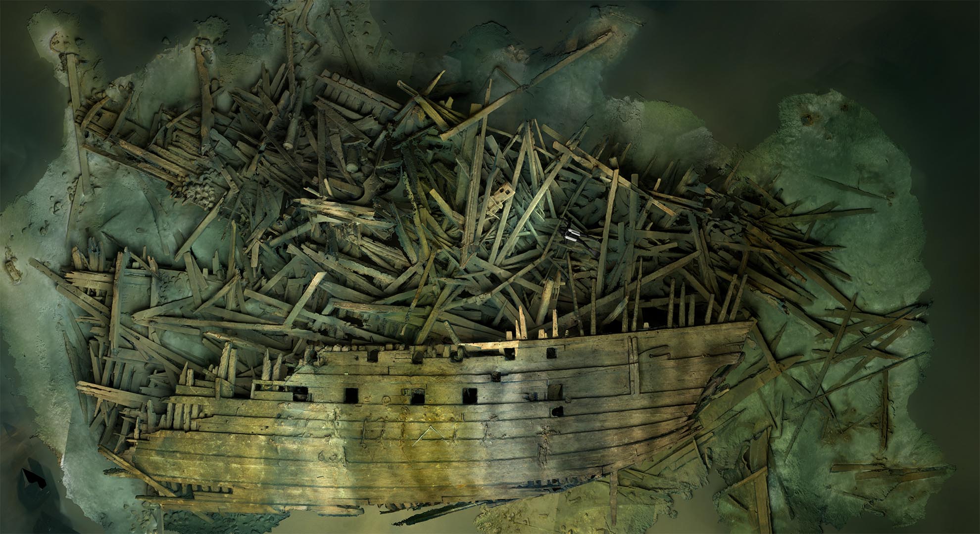
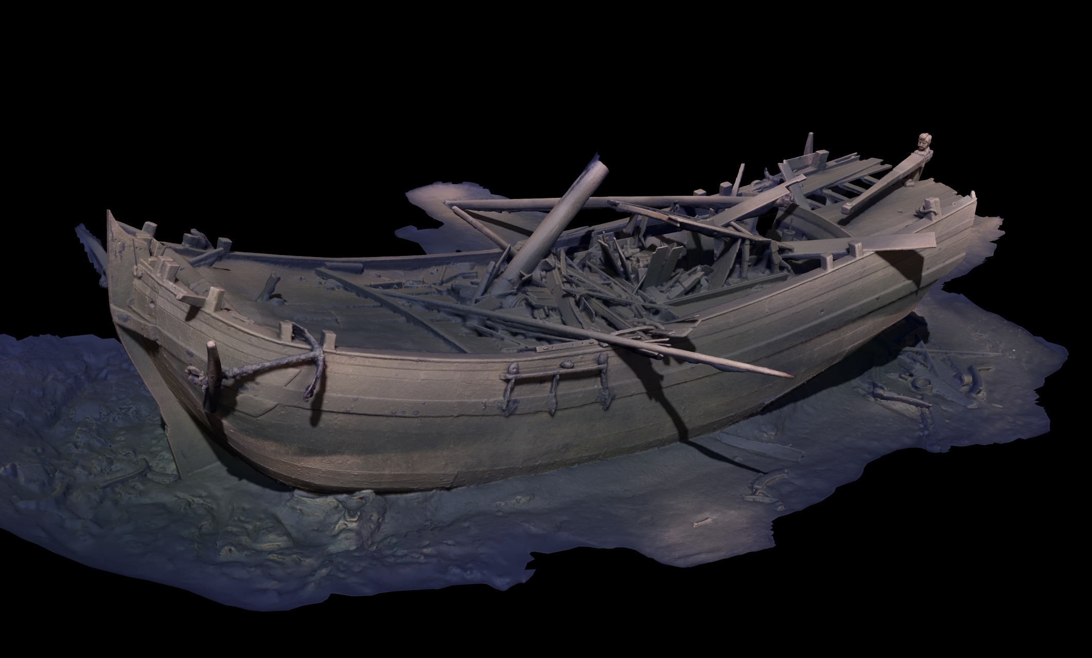
Photogrammetry and 3D scanning provide a fast overview of wrecks and remains while preserving the detail needed for archaeological interpretation. Orthophotos, DEM models, and textured 3D models make it possible to measure structures, document find positions, and compare site conditions over time.
DEM and GIS deliverables3D render of cannon wreck
Surveys and contract archaeology
Ahead of dredging, pipeline routes, and wind-farm development, we produce technical documentation for archaeological surveys and environmental impact assessments. Sonar, ROV, and photogrammetry are combined for efficient and traceable results.
Assessment ahead of developmentWreck inspection and interpretation
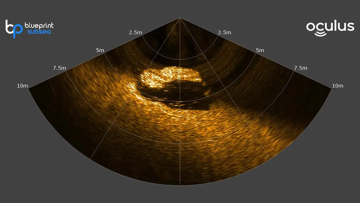
ROV, sonar, and positioned documentation
ROV inspections and sonar are used to locate, delimit, and document remains at depth or in environments where diving is impractical. Video, still imagery, and 3D models can be positioned with underwater positioning, creating clear references for reporting and further analysis.