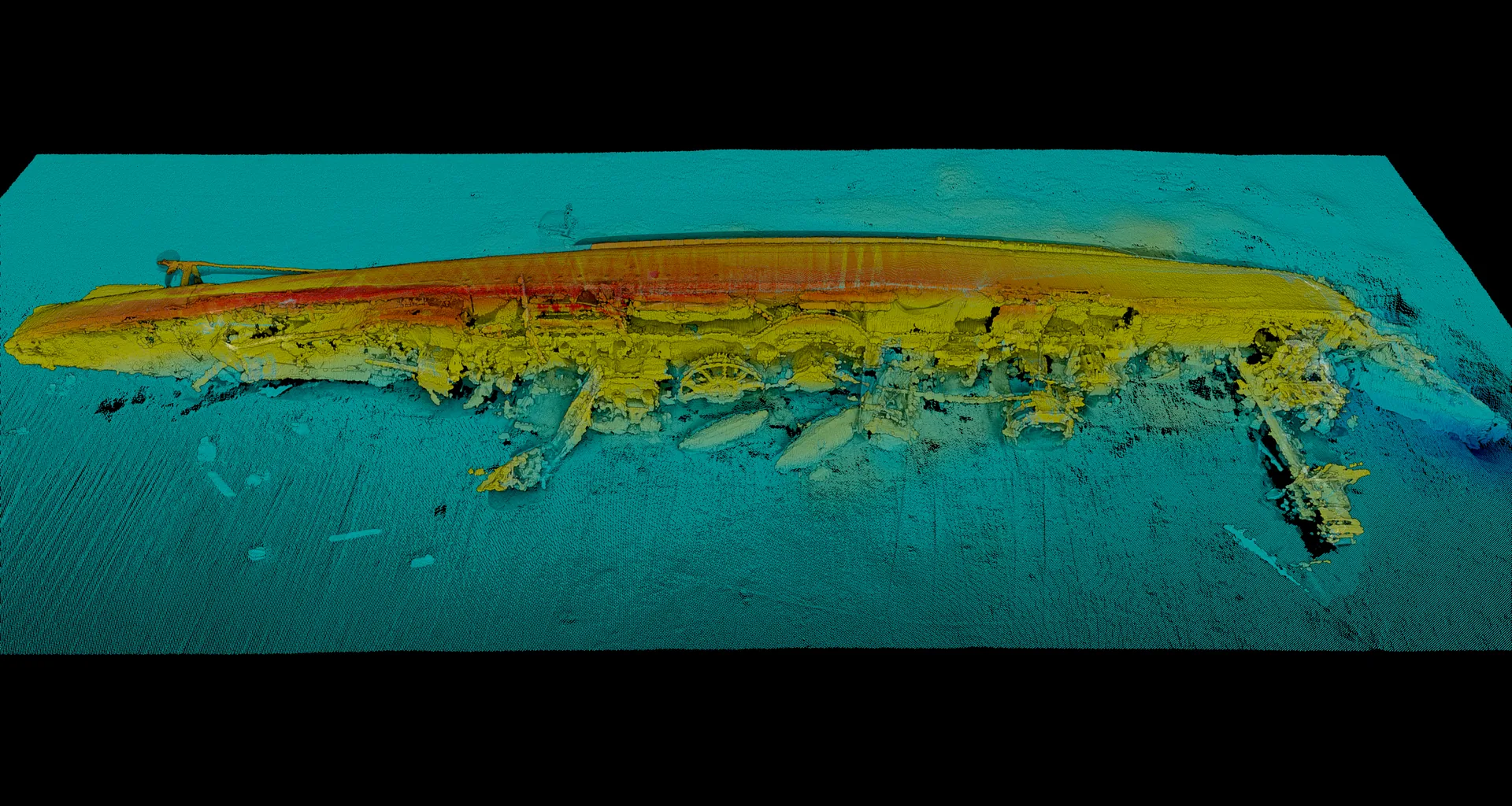
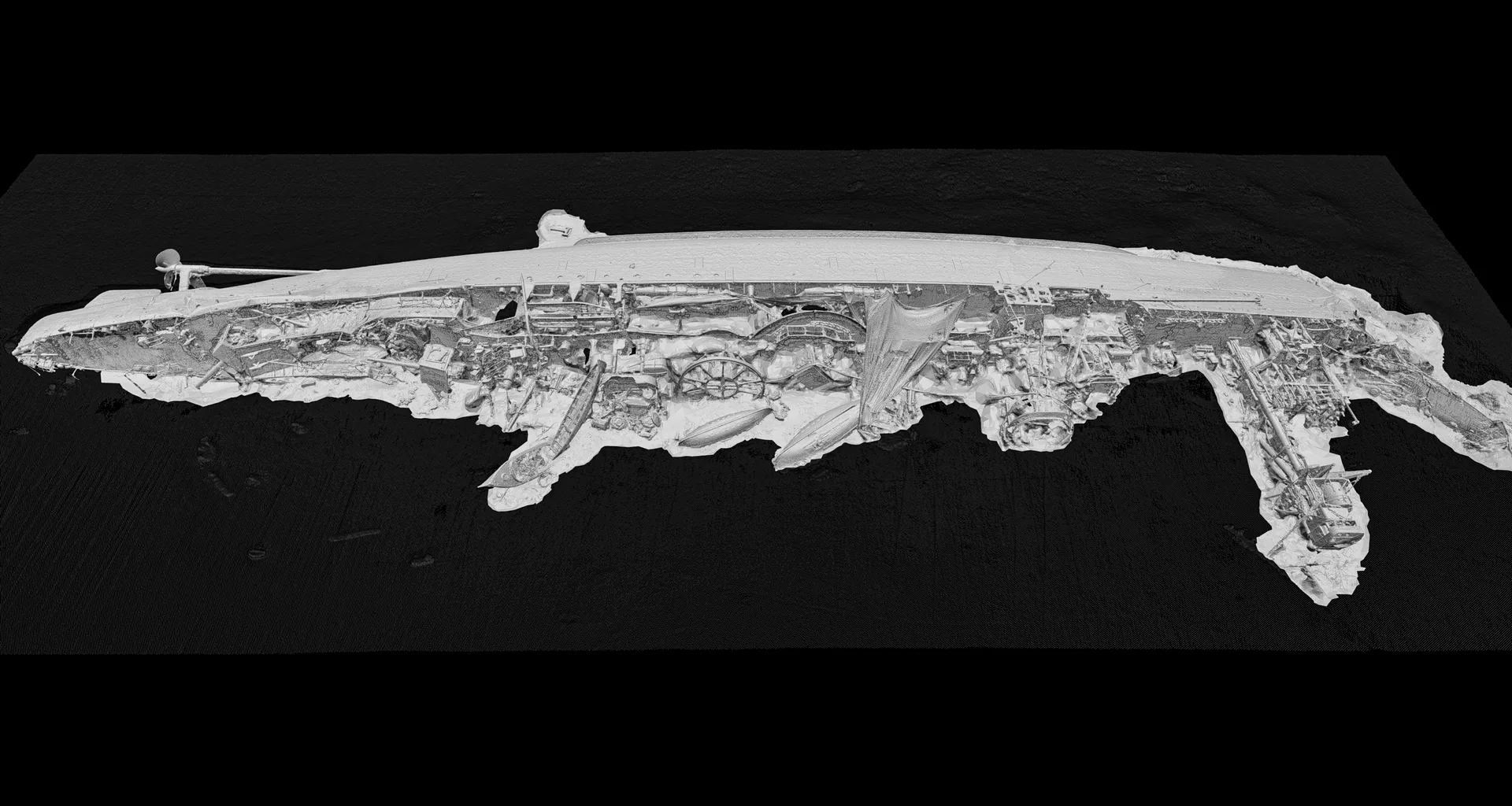
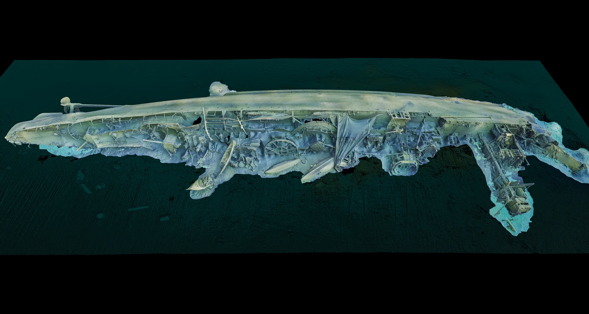
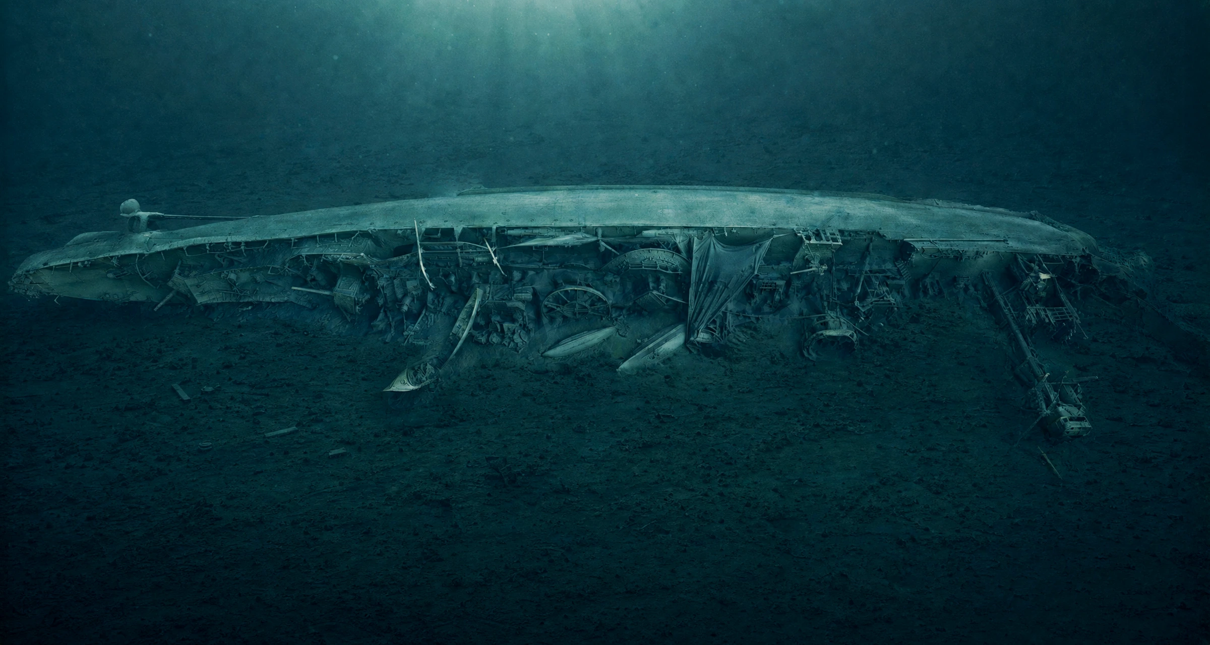
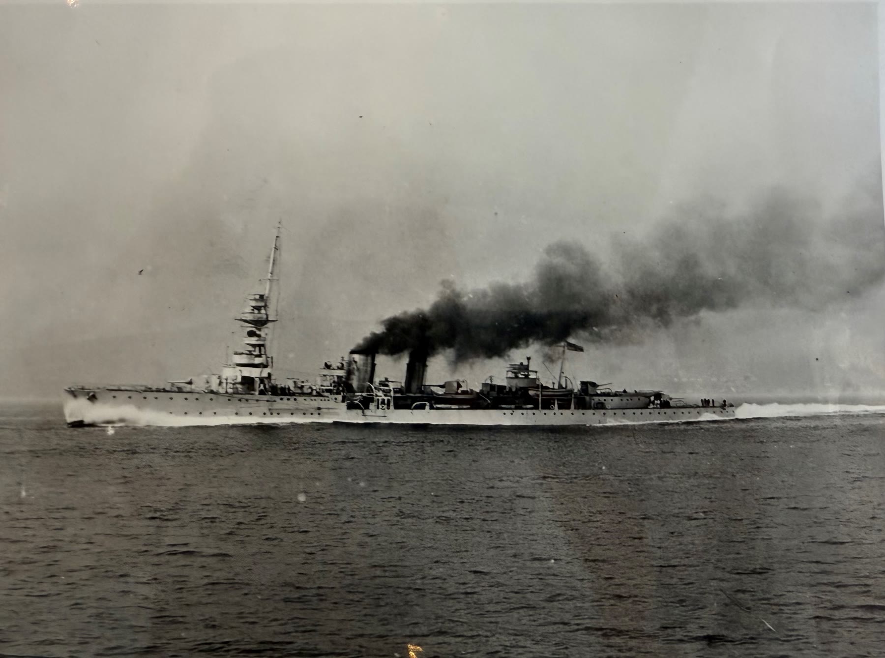
HMS Cassandra was a British C-class light cruiser that sank on the night of 4–5 December 1918. Bound for Tallinn, she struck a mine west of Saaremaa; eleven men were lost, the rest rescued. Today she rests on her starboard side at over 90 metres depth — the last resting place of British naval personnel, and a wreck that is still leaking oil.
The wreck is managed by the UK Ministry of Defence's (MOD) Salvage and Marine Operations (SALMO) Wreck Management Programme (WMP). She was first located by the Estonian Navy in 2010 and surveyed again by the Estonian Maritime Administration (today the Estonian Transport Administration) in 2015. The project began in January 2021, when Estonia approached the UK MOD's SALMO Wreck Management Programme about cooperating on the management of HMS Cassandra as a potentially polluting wreck. The Royal Navy survey ship HMS Echo mapped her in 2021. In 2025, Ocean Discovery carried out a detailed photogrammetric survey — via Waves Group — to build as detailed a picture of the wreck as possible and help inform SALMO Wrecks' ongoing management of her. The expedition involved Matt Skelhorn and Harriet Rushton (SALMO), Stuart Leather and Mark Lawrence (Waves Group), partner JD-Contractor A/S, and Estonian marine archaeologist Ivar Treffner (Eesti Meremuuseum), whose earlier dives on the wreck provided valuable reference material, together with Ayrton Hüüs of the Estonian Climate Ministry.
1918
The cruiser HMS Cassandra
A contemporary photograph of HMS Cassandra under way. The British Baltic squadron under Rear-Admiral Edwyn Sinclair Alexander-Sinclair was steaming east to support the newly independent Baltic states against the Bolsheviks when Cassandra struck a mine off Saaremaa.
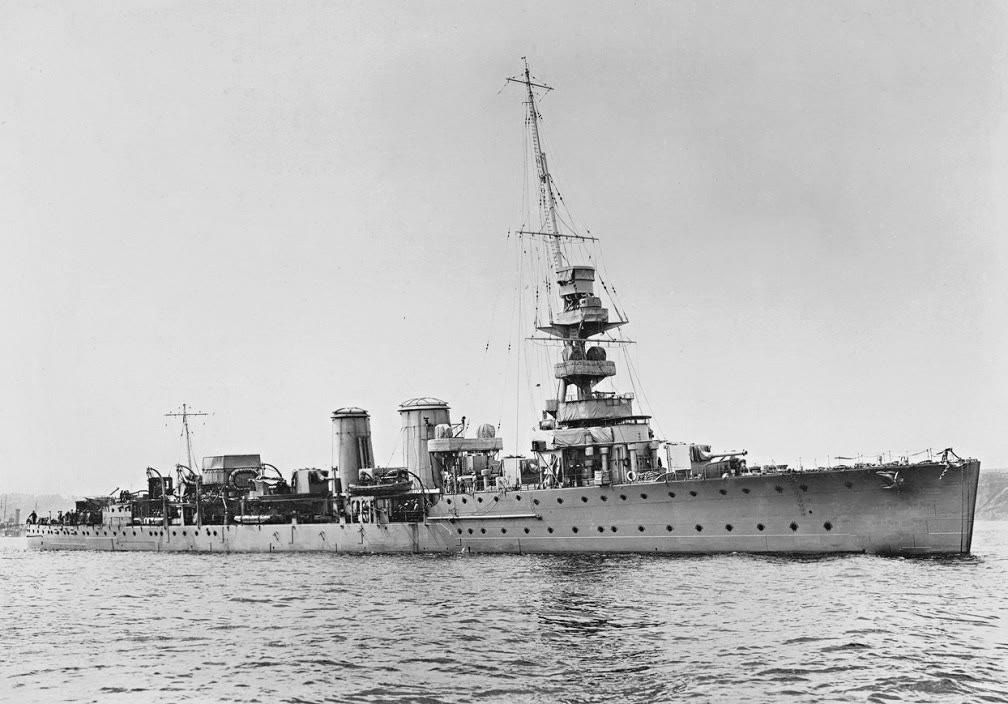
HMS Cassandra under way — a British C-class light cruiser. Royal Navy official photograph (IWM FL 7621, public domain).Sister ship HMS Calypso (Caledon group) — same class, the reference for our 3D reconstruction. Period photograph from the First World War era.
The wreck
The wreck up close
The model is built from over 15,000 photos at 50 megapixels each, taken at over 90 metres depth — and every image is precisely geo-referenced. In the 3D model (Nira.app) you can click any point, pull up all the original photos that built it and measure directly in the images — full traceability from a detail in the model back to the source evidence itself, measurable on the spot. The resolution is high enough that even a small pipe, perhaps the captain's, is captured. The model is now openly available in Nira.app.
In the 3D model — the pipe shows up as a small elongated object, captured despite its tiny size.Dive photo of the pipe, perhaps the captain's — a detail that shows the survey's resolution.The fire-control tower, with an open hatch.The bridge, with window openings intact.The range finder — part of the fire-control system.The aft gun — barrel and shield.The capstan with the Royal Navy insignia — still legible.One of the ship's boats — the wheel visible inside.
— HMS Cassandra in numbers
Sank
1918
Mine in a German minefield, night of 4–5 December.
Depth
90–100m
Rests on her starboard side, west of Saaremaa.
Fuel oil on board
673–744t
Estimated amount on board when she sank in 1918, per the historical assessment.
Lost
11
Of around 400 on board — the wreck is their last resting place.
Documented
2025
Digital twin for the UK MOD, via Waves Group.
On board
UXO
Torpedoes and depth charges located.
Method
Multibeam and photogrammetry — in one model
One of the assignment's technical highlights was combining two independent survey methods in a single model. Multibeam echo sounding (MBES) provides a geo-referenced bathymetric picture of the wreck and the seabed around it, while photogrammetry delivers millimetre-resolution surface and structural detail. The multibeam survey was carried out by partner JD-Contractor A/S using their Argus Mariner ROV, operated from the vessel Vina, while Ocean Discovery handled the photogrammetry. By overlaying the MBES data onto the photogrammetry model and its point cloud, we produced a single, fused dataset — in which the two methods validate one another and cover each other's weaknesses. The result is a dimensionally accurate digital twin with both overall geometry and fine detail, geo-referenced and directly measurable. The interactive visualization at the top of the page lets you drag between the four layers of this pipeline — from raw MBES sonar to the finished model.
JD-Contractor's Argus Mariner ROV on deck — the vehicle that carried out the multibeam survey.Ocean Discovery's own M500 ROV, rigged for high-resolution photogrammetry.Launching the M500 over the side ahead of the next dive.The survey control room on board — live ROV feed, camera views and multibeam bathymetry side by side during work on the wreck.
Oil on board — why an environmental survey
During the survey, HMS Cassandra was seen to be leaking small amounts of oil. When she sank in 1918 she is estimated to have had 673–744 tonnes of fuel oil on board, according to the historical desk-based assessment. Her tanks held roughly 1,083 m³ in total, and based on the ship's plans, survey data and subsequent analysis an estimated 453–839 m³ of oil is believed to remain in the wreck today. The purpose of the assignment was environmental: to document the wreck's condition in detail and gather the material needed to inform appropriate management by SALMO Wrecks, on behalf of the UK MOD. Ocean Discovery built a digital twin of the wreck — a dimensionally accurate 3D model in which every detail, including areas of damage and leak points, can be studied and measured without disturbing the site. The digital twin becomes the working basis for the future management of the wreck.
Explosive load — UXO on board
HMS Cassandra was a warship when she sank, and so munitions remain on her wreck. During the documentation, torpedoes and depth charges were located and recorded. Knowing exactly where the explosive load lies is essential for any future management to be planned and carried out safely — for example oil remediation. Should the oil be remediated, the photogrammetric model provides a precise map of both the oil and the explosive ordnance before any work begins, ensuring as safe and environmentally considerate an operation as possible.
3D model of the stern — the depth charges are visible at the railing on the left of the frame, where the stern begins.Depth charges on board, documented in situ.In the 3D model, the torpedoes appear as long, tube-shaped objects among the wreckage.Close-up of a torpedo — partly covered by ghost netting.